"The Cure for Everything is Saltwater, Sweat, Tears, or the Sea."

About Us

My photo
San Juan Archipelago, Washington State, United States
A society formed in 2009 for the purpose of collecting, preserving, celebrating, and disseminating the maritime history of the San Juan Islands and northern Puget Sound area. Check this log for tales from out-of-print publications as well as from members and friends. There are circa 750, often long entries, on a broad range of maritime topics; there are search aids at the bottom of the log. Please ask for permission to use any photo posted on this site. Thank you.
Showing posts with label author Lucile McDonald. Show all posts

07 April 2025

The MASSACHUSETTS, THE FIRST AMERICAN STEAMSHIP TO VISIT PUGET SOUND, all the way to San Juan Island.


The MASSACHUSETTS
Postcard copyright 1896
Click image to enlarge.
Published by the Metropolitan News, Boston.
from the archives of the 
Saltwater People Historical Society©

"The Spring 1970 issue of Steamboat Bill, the quarterly of the Steamship Historical Society of America, carried a story on the "The Auxiliary Steam Packet MASSACHUSETTS." This historic vessel, built in 1845 at the East Boston shipyard of Samuel Hall, was given detailed chronological treatment of her rig and power plant changes with abbreviated accounts of her West Coast activities in between. The narrator related that she was transferred by the War Department to the Navy at Mare Island, CA., on 1 August 1849 and that she served as a storeship until 1853 when she returned to Norfolk, VA., to have new boilers installed. Then, he says, she sailed to the Pacific in July of the following year, and in 1855, she was listed as a storeship at Acapulco. Then he concluded that her name had been changed, and in 1862, she became the FARRALONES, which was still a storeship and coal ship in San Francisco.

Some of the most colorful chapters in the vessel's history were largely concerned with the Pacific Northwest, where her name loomed big in maritime movements. The MASSACHUSETTS performed so many important government duties in these parts that it seems fitting to give readers some details about these activities.

The MASSACHUSETTS was first heard of in this region when she arrived off the mouth of the Columbia River on 8 May 1949 with the first important contingent of American troops to be stationed in this area. On 13 May, the force arrived opposite Fort Vancouver and was landed the following day.

This was the end of a month's voyage from New York around Cape Horn. The vessel carried 161 officers and men of the First Regiment, U.S. Artillery companies M and Lk, commanded by Brevel Major J.S. Hathaway. Some would remain at Fort Vancocuver, where they would wreck barraks. Others were destined somewhat later to establish Fort Steilacoom for the protection of settlers on Puget Sound.

On the way to the Pacific Coast, the vessel created a stir when she entered Honolulu harbor on a calm day without the help of canvas. Astonished Hawaiian natives crowded the  beach to see the phenomenon, and an island newspaper headlined the went, "Arrival Extraordinary."

At that time, the sight of a vessel equipped with both sails and propeller was unusual. Steamboat Bill describes her equipment. The MASSACHUSETTS was 160 feet L on deck x 20 ft D x 32 ft B and measured about 776 tons. She was full ship-rigged and her steam power was strictly auxiliary to her canvas and was intended to be used occasionally when near land and in smooth water or to get in and out of port.

The motive power was a two-cylinder condensing engine capable of about 170 HP or a speed of nine statute miles per hour in smooth water. The engine and boilers were in the lower hold, with space in the wings for oal bunkers. The propeller was a six-bladed Ericsson screw 9 1/2 feet in diameter that could be lifted out of the water when the ship was under sail.

The MASSACHUSETTS was the first American steamship to visit Puget Sound. She anchored off Fort Nisqually on 25 April 1850. The story of how she got here goes back to the plea of Governor Joseph Lane of Oregon Territory for better aids to navigation and more protection for settlers and shipping.

On the last night of the 1850 session of Congress, Samuel P. Thurston, delegate from Oregon Territory, succeeded in founding up and getting into their seats enough representatives who would vote for his bill to set aside $53,140 for erection of lighthouses at Cape Disappointment, Cape Flattery, and new Dungeness, also installation of 12-iron-can buoys in the Columbia River. The measure passed, but the money was not spent immediately.

Meanwhile, the MASSACHUSETTS had brought the troops to the Columbia River and, after delivering the soldiers, had been sent back to San Francisco, where she was transferred to the Navy to transport a newly appointed commission. Its purpose was to examine the coast of the western United States lying upon the Pacific Ocean concerning points of occupation for the security of trade and commerce and for military and naval purposes." The ship was in command of Capt. Samuel Knox.

She sailed from California and was off the Columbia River on 20 April 1850. Her visit to Nisqually was duly recorded in the journal of the Hudson's Bay Trading post. It mentioned that Lieutenant Danville Leadbetter, representing the Army, was of the Topographical Corps and that he and the doctor called at the fort.

While in the area, the MASSACHUSETTS called at Victoria and Esquimault and continued north through the Gulf of Georgia to Beaver Harbor to take on coal. She rounded the north end of Vancouver Island and followed the route south. On the coast of Washington, she stopped at the mouth of Willapa Bay, where a party was dispatched to scrutinize the harbor. (This occasion was honored later when Leadbetter Point was named.) Part of the purpose was to determine how close the bay was to the Columbia River. A whaleboat was hauled over the portage between the two bodies of water with the help of a dozen or more Natives.

The commission reached Astoria on 30 June and examined the lower Columbia, arriving at Portland around the 11th of July. The MASSACHUSETTS next sailed for the Umpqua River and arrived back on San Francisco Bay around 1 September.

The Steamboat Bill article accounts for the MASSACHUSETTS next activity. After her return from Norfolk, VA., she came back to Puget Sound to replace the DECATUR, sent here during the Native American troubles of 1854.

In April 1855, citizens of Port Townsend requested the government to assign a war vessel to cruise between Bellingham Bay, Dungeness, Port Townsend, and Foulweather Bluff to guard against incursions of Haida and other Northern Natives from British Columbia. The MASSACHUSETTS was immediately sent back to Puget Sound and, early in 1856, was dispatched to Port Gamble to disperse a gathering of Canadian Natives. When they refused to leave, she opened fire and killed 27, which caused the Natives to vow vengeance. They later killed Col. Isaac S. Ebay on Whidbey Island in reprisal.  

The MASSACHUSETTS again played a role in local history in 1859 when she steamed out of Steilacoom with troops for the "Pig War" in the San Juan Islands. She also picked up Capt. George Pickett's company at Fort Bellingham and moved the soldiers to San Juan Island. The vessel played its final part in the unrest when Maj. Gen. Winfield Scott made her his headquarters while he was on Puget Sound on behalf of the president to settle the difficulty, resulting in joint occupation of the islands by both British and American troops. Scott left on the MASSACHUSETTS after his negotiations. 

After the MASSACHUSETTS name was changed to FARRALONES, she was drafted for the Civil War. In 1867, she was sold to Moore & Co. of San Francisco, and the last reference to the vessel as bark ALASKA, owned by that firm. No records of her existence after 1871 can be found but Steamboat Bill says she is reported lost on the coast of Chile in 1874."

Words by author/historian Lucile McDonald who wrote thousands of historical essays for the Seattle Times newspaper and many for The Sea Chest published by the Puget Sound Maritime Society. 

Some of her sources:  Steamboat Bill journal of the Steamship Historical Society of America.

Published in The Sea Chest journal of 1970 from the Puget Sound Maritime Society, Seattle, WA. 

08 February 2024

DAYS OF BLOOD IN THE EARLY LIME QUARRYS----from 1860-- 1959 with Lucile McDonald


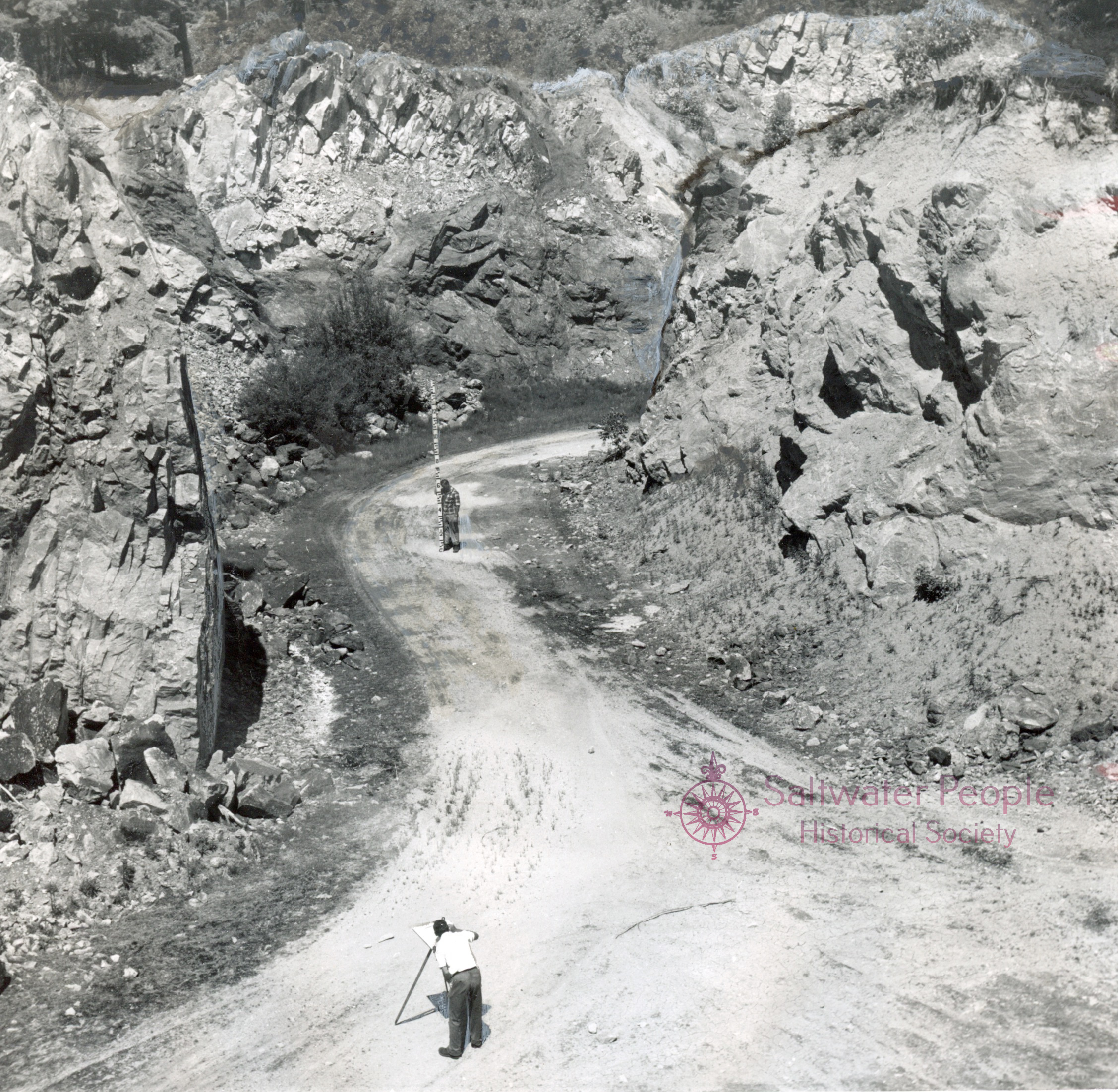
Remains of the old Cowell quarry
stands on a hillside of
western San Juan Island,
where the Island's limestone industry began.
Photo dated 1959.
Click image to enlarge.
Photograph by W.R. Danner.
From the archives of the
Saltwater People Historical Society©

"Geologists this summer (1959) combed the San Juan Islands in a study of limestone deposits, trying to determine how much of the mineral resource remains on the islands and how practical the deposits are for exploitation.

Long ago the white substance furnished the principal year-round payrolls in the islands and was one of the factors in their settlement. Quarrymen, kiln-tenders, and coopers comprised an important part of the population between 1870 and the end of the century. 

Dr. W.R. Danner, a Seattle geologist on the U of British Columbia faculty, headed a crew sent out by the Division of Mines and Geology of the State Department of Conservation to make a comprehensive survey of the deposits in the past three months. He worked mostly in the San Juans and in Skagit County, while Dr. J.W. Mills of WA. State University, with a similar crew, carried on the search east of the Cascades.


Dr. W. R. Danner,
Seattle geologist, at the door of 
a disintegrating limekiln at the former
Eureka site on San Juan Island, WA.
Click image to enlarge.
1959 photograph by Parker McAllister,
from the archives of the 
Saltwater People Historial Society©


Industries such as pulp manufacturing consume enormous quantities of limestone, now being imported into Washington because of lower production costs elsewhere.

At present, only one operator, of the Everett Lime Co. deals in this commodity from the islands. He employs a crew to blast rock from the Westerman quarry at Eastsound, Orcas Island, break it into chunks called 'spalls', and load it on barges to be taken to pulp mills.

The market for Washington limestone has shrunk greatly. Only in cement manufacturing is it expanding. However, this outlet requires large and easily accessible deposits.

It was once supposed there was so much limestone in the San Juans that possession of tiny O'Neal Island alone was sufficient reason to justify the British-American boundary dispute of 1859. 

Danner found this century-old idea amusing because, although limestone is visible on the surface of O'Neal, the island on close examination proved to have a negligible amount of the mineral.

'Islanders think lime is all over the archipelago,' Danner said. 'This is not true. It is found in small deposits; there are no great sheets of it. We want to discover what actually is here, what is left in the quarries, and what deposits have not been quarried.'

With his two assistants, Danner tracked down forgotten places such as limestone caves, crumbling towers that once were kilns, and prospect holes in picturesque fern-filled glens where early-day miners did not find enough mineral to justify quarrying.

'There are nine groups of quarries on San Juan Island and at least 14 groups on Orcas.' Danner said 'The Roche Harbor operation on San Juan, which ended several years ago after having been the largest on the Pacific Coast, had 12 quarries.'

The Roche Harbor plant was modern, compared with the ruins of earlier ones scattered in the islands. The towering old stone kilns, into which rock was dropped from the top and drawn out through oven doors at the bottom, have a medieval look about them.

Seven kilns can be seen on San Juan, ten on Orcas, two on Henry, and one in ruins on Crane, Danner says. The geologist found 21, including some which have almost disappeared.

Inaccessibility usually was the factor governing the closing of the old mines. A few were abandoned because of the height of overhanging cliffs, which threatened landslides. Another was shut down because of the death of a workman. Most became too costly to operate.

Danner had explored for lime in the islands in previous summers for private companies. This year he thoroughly examined San Juan, Orcas, Henry, Cliff, Crane, O'Neal, and Jones Islands for the state. He mapped old workings, took samples, and assembled all the lore he could extract from residents. Many of the lime properties have become residential sites.


Charles McKillop, Friday Harbor, foreground 
& Alder Revisto, of Tacoma, survey the old 
Cowell quarry in 1959, on San Juan Island,
San Juan County, WA. 
They were assistants to Dr. W.R. Danner.
Click image to enlarge.

Photo by Danner from the archives of the 
Saltwater People Historical Society.©

The industry began on San Juan Island's west side, on the cliffs near Lime Kiln Lighthouse.

Augustus Hibbard, who became the island's first quarry operator in 1860, was a man who attracted trouble. Military authorities were annoyed with his men for keeping liquor in camp and selling it to soldiers and Indians. Hibbard's cook was stabbed to death by a cooper and Hibbard himself was killed by his partner, on June 17, 1868, in a quarrel over an Indian woman.

Hibbard died just before the completion of a new kiln. His heir, who journeyed from the East to take possession, died two years later. The federal census of 1870 indicated that the firm then employed 18 persons and in 12 months had produced 13,000 barrels of lime, worth $26,000.

Lime at that time was used mainly for mortar and as a soil 'sweetener' in agriculture. None had been discovered closer than California or Vancouver Island, so trade in Washington Territory appeared to offer good prospects.

George R. Shotter, a Canadian, opened the first quarry on Orcas about 1862, across Eastsound from the site where Clauson is mining today (1959.) The Shotter site, north of Rosario on Eastsound, is owned by the Crown Zellerbach Corp. Two ruined kilns on the beach are all that remains of the lime settlement of Port Langdon, which existed before there was a town of Eastsound.

Nova Langell, an old resident of the island, is a son of Ephraim Langell, a Nova Scotian who went to work at the quarry in 1871. He recalled that the company's oldest kiln has disappeared: the two standing on the shore are later ones.

In 1874, after American ownership of the San Juans was agreed through arbitration, the British quarry firm sold to Daniel McLachlan, an employee, and Robert Caines of Port Townsend, who later bought McLachlan's interest.

McLachlan went to the east side of San Juan Island and, with his brother, William, and Thomas H. Lee, a relative by marriage, in 1881, organized the Eureka Lime Kiln, on what became the property of Mrs. D.M. Salsbury.

Seven little quarries are scattered through the woods on Mrs. Salsbury's 250-acre tract and two kilns stand on the beach. Once a small community was on the spot, including a hotel, post office, saloon, and 20 families.

Eureka is one of the oldest quarries in the islands, older than the McLachlan-Lee enterprise. Probably it was opened by an Englishman named Roberts during the joint military occupation of San Juan by the British and Americans. Early in 1863, American squatters attempted to seize it from him through an illegal order of the Justice of the Peace. The controversy ended with Roberts's death by drowning before the year was out.

The Eureka property has not been operated since about 1890. Mrs. Salsbury converted two of the quarries into a Japanese grotto and a woodland chapel. Rock from one of the kilns was used for building her chimney and fireplace.

Danner found the forgotten quarry of the Chuckanut Lime Co. on the east side of Point Lawrence, Orcas Island. It was abandoned before 1910.

One of the most spectacular quarries, Danner said, is on the west side of Orcas Island, about 300' up in the cliffs, where the Orcas Lime Co plant for many years was operated by a woman, Mary Louise Dally. She and her husband, F.W.R. Dally, bought the original kiln on the President Cannel side of the island in 1900.

From 1914 until she died in 1928, Mrs. Dally had lime properties on San Juan and Henry Islands, including one with an ancient pot kiln, the most primitive type of oven to be seen in the archipelago.

Part of Danner's objective has been to learn the age of the limestone deposits in the islands, using tiny fossils of one-celled creatures that lived in shallow sea-bottom and were uplifted after the age of glaciers. On Orcas, he found limestone 350,000 years old.

The fossils, Danner said, are dependable clues to the age of any land where they exist. Through their presence, scientists have determined that the San Juan Mountains (now submerged, the islands are their peaks) ca. 200,000,000 years older than the Cascade Range.

The basic purpose of the summer work has been to learn whether suitable deposits of limestone are available to attract new industries.

Whereas kilns used to be of backyard proportions and a 200-barrel shipment was considered newsworthy in 1875, today's thinking has to be on a gigantic scale. If quarrying should reopen in the islands it will have to be undertaken by some large corporation financially able to overcome the physical obstacles and install an economical burning plant."

Words by historian/author Lucile McDonald and published by the Seattle Times.

01 January 2021

❖ CHASING RUM ON PUGET SOUND ❖

Lucile McDonald (1898-1992) was an amazing journalist/historian/author on the prowl for Washington State history. Let's once more follow her trail through Puget Sound when she was beach-combing for tales of the rum-running days during the Prohibition Era.

~~~~~~~~~~~~~~~~~~


Roy T. Lyle,
Federal prohibition chief, 1 June 1922,
with part of the shipment of "salt fish" liquor 
seized in a Seattle freight shed.
Click image to enlarge.
Original photo from the archives of the 
Saltwater People Historical Society©
If one waits long enough, almost any true experience becomes a collector's piece.
      National Prohibition ended in December 1933; it was the following March before Washington's first state liquor stores were in business.
      For nearly 14 years the entire United States had been dry. Washington had suffered thirst four years longer than that because of a Prohibition Law of its own, effective 1 January 1916.
      Sufficient time has elapsed so that minor actors in the drama of the Prohibition Era feel that now their part can be told. One of them volunteered the information that he was hired to work on a farm at Washington Harbor, Clallam County, and discovered its owner was a bootlegger, ostensibly raising turkeys and hay. The main purpose of the hayfield was to conceal a ditch in which liquor was stored.
      Another told how his father had moved from Samish to Sucia Island because farming was not as profitable as repackaging liquor goods. He removed bottles from boxes and repacked them in gunny sacks.
      "Yes, but some other repackaging was done, and not always on the level," another man commented. "You might be paying $120 a case for good liquor. You received it in a straw-stuffed gunny sack with a handle. You opened it and what did you have--three bottles of good liquor and the rest of the bottles filled with tea!"
      One of the men who gave stories to the State had been employed on a railroad. He related that a small-time bootlegger proposed that a train conductor let him store cases of whiskey between the walls of the caboose.
      Space was found for four cases each trip. They had cost $50 apiece in Canada and the bootlegger doubled his money in Bellingham.
      "He made $2,500 a month easily," said the trainman.
      "He paid me $10 a day just to stay in the car so that nobody would hijack his goods."
      The same narrator recalled deliveries made in Bellingham with buttermilk jugs, painted white, filled with moonshine retailing at $8 a gallon. Painted milk bottles also were delivered, customers paying $3 a quart "for that kind of milk."
      The trainman spoke of shingles which were loaded by the carload at a Canadian mill, where a bootlegger would have an arrangement to place some of his wares on board at the same time.
      Shingles would be piled densely in front of the car door and, when customs officers inspected the car at Blaine, the contents looked innocent. Hijackers, however, sometimes received a tip on the number of the car and stole the liquor before it reached its destination.


Coast Guard cutter Arcata
with a captured "rum runner" vessel.
Stamped with date of 25 August 1924.
From the archives of the 
Saltwater People Historical Society©


Speedboats carrying contraband cargo came directly to Seattle and landed cases on piers or at suburban beaches. Some commonly passed through the Government Locks and put their cases ashore on a county wharf at the foot of Stone Way. A man who worked at a boathouse nearby said that two or three trucks stopped there regularly at night to pick up liquor.
      Shipments for large-scale bootleggers left British Columbia ports on "mother" ships, ostensibly bound for Guatemala and Mexico. They hove to outside the 12-mile limit and discharged into "daughter" ships, which delivered the contraband cargo to the San Juan Islands, where they were met by speedboats. These in turn carried the goods to Seattle or nearby points.
      In 1925, the Coast Guard employed 22 vessels on Puget Sound and in nearby waters to lie in wait for the liquor craft. Frequently a thrilling chase occurred, when the sound of firing brought Whidbey Island residents out in the night to watch the pursuit from the bluffs.
      If a fleeing craft ignored a signal to halt, the Coast Guard fired a shot across the bows. If the fugitive vessel still did not stop, the Coast Guard unlimbered a Lewis machine gun.


Coast Guard with their Lewis gun on deck.
Motoring out of Anacortes, WA.
Photo dated 1931 from the archives of 
the Saltwater People Historical Society©

      Sometimes, if badly shot up, a pursued vessel made a crash landing on a beach and the crew disappeared in the bushes. Most bootleg vessels were faster than the patrol craft and could outrun them.
      Liquor commonly was packed 12 bottles to a gunny sack. Sometimes these were towed from the stern, ready to be cut adrift.
      One method of delivery was to place rock salt and cut cork with the bottles in the sacks. They sank when dropped overboard, but a few hours later, after the salt had dissolved, the sacks were floated by the cut cork and retrieved by a watch onshore.
      Liquor frequently was stowed under lumber, logs, and sawdust on barges in tow from Canada, or buried on sand scows. It might be shipped in barrels and kegs, in metal pipes that appeared to be part of engine-room fittings, or in a gasoline tank supposed to contain fuel.
      In the last years of the Prohibition Era, one former Coast Guardsman said, the heavy traffic was in canvas bags fastened underneath log rafts being towed.
      "A tugboat fellow," he related, "told me about a tow of cedar logs from Ladysmith with a queer gimmick. Several hollow logs were filled with cases of liquor and the ends were plugged with sacks of sand."
      The former officer's most unforgettable adventure had to do with a craft that always carried a cargo of scrap metal. The skipper made about three round trips every week into the San Juans ostensibly buying old iron. It always looked the same and the revenue men were suspicious.
      One night in 1925 off Point No Point, the craft went by in the kind of weather that would send most vessels to shelter. The revenue cutter went alongside and hailed the skipper.
      "One of the seamen--he was just a kid--noticed a short piece of rope trailing in the water," the former Coast Guardsman said. "He snagged it with a pike pole, gave a strong pull, and, as it came loose a case of whiskey came with it. The searchlights were turned on and we could see a secret compartment built under the keel. We had tapped that boat all over and it never gave forth an echo, the false bottom was so cleverly built. It had space for 24 cases.
Text above by Lucile McDonald for the Seattle Times 1961.


19 April 2020

❖ HISTORY BACKS SEATTLE'S TRADE WITH THE ORIENT ❖

Click image to enlarge.
"Foreign trade programs for the Pacific Northwest today bear down heavily upon development of Oriental markets. Expansion of the Port of Seattle, encouragement of shorter trade routes across the Pacific, a shipment of West Coast products to Asia––these are variations of the same theme. 
      It is not a new idea. On the contrary, it is a very old one, for the Pacific Northwest's first exports went exclusively to the Orient.
      Had it not been for the Chinese mandarin's insatiable desire for fur linings for his silken garments, the Pacific Northwest might have remained unknown terrain much longer than was actually the case.
      Chinese homes were cold in winter and padded garments were the only answer to a real need. In wealthier circles, cotton wadding was scorned and fur, particularly sea otter, was the lining of fashion. Northwest America had plenty of furs and the sea-going nations of the 18th Century rushed in to profit from the trade.
      Puget Sound and its ports were unknown in that era; the two fur emporiums of the vast Oregon country, which extended far into Canada, were situated on the Columbia River and at Nootka, a now almost-forgotten cannery station on the west coast of Vancouver Island. All of the furs taken by the natives in the area tributary to Puget Sound passed into the hands of white men at one of these parts or the other.
      Furs were the only item of exchange and they were slated for export to a single destination––Canton, China. Sometimes, it is true, they were carried only as far as Hawaii, then known as the Sandwich Islands, and here they were transported on vessels bound for the mouth of the Pearl River.
      Chinese trade was surrounded by mystery and bound by strict formalities. The fur-laden ship came into the Portuguese port of Macao, picked up a pilot, and went upstream to the anchorage of Whampoa, the closet large vessels could approach the shallow harbor of the delta port. From this point, the pelts were lightened the remaining ten miles or so and deposited in warehouses in an enclosed area. The ship's crew saw nothing of this place; only officers were allowed there and their stay was limited to the trading season. A Chinese merchant acted as a go-between, disposing of the sea-otter skins, so crudely cured by Native Americans of Puget Sound and other Northwest inlets. The same merchant reloaded the vessel with teas, silks, and oriental wares destined for British ports or for those on the east coast of the US.
      Even these meager direct contacts between Puget Sound and the Orient were amazingly lacking for many years, simply because the exact location of the Strait of Juan de Fuca was unknown. It was one of those semi-mysterious bodies of water in a class with the Northwest Passage and the Strait of Anian. A Greek sailor, Juan de Fuca, was said to have seen the inlet in 1592 but upon the latter part of the 18th Century, no one had tested the merits of his story.
      The first expedition to this region for business––in other words, furs––was conducted by Capt. James Hanna, who sailed direct for Nootka from Macao in April 1785. Several other ship captains followed him to Vancouver Island in the same year, but the Strait of Juan de Fuca remained unexplored until Capt. Charles William Barkley in the Imperial Eagle, flying the Austrian flag, nosed his ship into the waters of the Sound sometime in 1878. According to the diary of his wife, who sailed with him, he was the first man to trade with Natives south of the strait. However, this did not prove a fortunate enterprise and the Natives at the mouth of either the Hoh or the Quillayute Rivers killed several of his men. 
      Capt. John Meares obtained a copy of Barkley's log and, in the summer of the following year, he too stopped at the mouth of Juan de Fuca and cast a speculative eye eastward. Meares had come from Oriental ports and his venture to the Northwest was under a cloud, so much so that he carried a Portuguese flag in case some other British sea captain challenged his right to be in these waters. Meares dispatched Robert Duffin in a longboat to investigate trading possibilities inside the sound.
      Duffin stayed out a week and may have penetrated as far as Port San Juan. In any case, Mears claimed possession of the strait for Great Britain and, while he was primarily engaged in taking on sea otter pelts, he did not overlook another possible cargo.
      All of the early explorers had noted the desirability of Douglas fir for spars and had been cutting them for their own needs during their voyages along the coast. Mears went a little farther. He is reputed to have taken aboard a load of spars to sell in China.
      Naturally wood did not compare in value with furs, so, for 25 years or more, the latter continued to be the drawing card of trading vessels plying between the Northwest and Canton.
      Knowledge of the extent of the Sound was acquired gradually. Capt. Robert Gray was the next visitor, in 1791. Then, in the following year, Capt. George Vancouver arrived and explored the region more thoroughly.
      
Click image to enlarge.
Original vintage card
from the archives of the
Saltwater People Historical Society©
Meares was not the only wily fur trader who thought of carrying Washington wood to China. At the Hudson's Bay Post at Fort Vancouver, a tiny sawmill had been operating several years when, in 1833, the company conceived the idea of sending some of its output across the Pacific. This lumber was crudely sawed, for it was originally intended only for the trading post-settlement. Logs made into small booms were towed by canoes down the Columbia to the fort. Cutting was accomplished by the simple expedient of whipsawing by hand, one man standing in a pit under the log and another standing over it, working a cross-cut saw. This outfit could turn out only 3,000 board feet a day, which soon was insufficient to meet the demand.
      The Hudson's Bay Co., obtained better mill equipment from England, installed it at Vancouver and sold the first crude rig to loggers at Tumwater, where the second sawmill in the state was put into operation.
      This was the beginning of logging on Puget Sound. Another mill went in at the mouth of the Nisqually River in 1851, a third was installed at the present site of Tacoma in 1852 and in the following year Henry Yesler built his steam sawmill at Seattle. By the end of the decade, 32 sawmills were operating in Washington, 25 of them on Puget Sound.
      The circumstances which turned the pioneer farmer into a woodsman were created by the need to clear land before using it for agriculture. Almost every old settler at some time or another engaged in shaving shingles. It would have been difficult to find one who had not cut poles. Seattle's original group of families, while still at Alki Point, cut 13,000 feet of piling to provide cargo for the brig Leonesa.
      This wealth of timber and the need to remove it to provide space for homes and farms was a great factor in reviving Puget Sound's dwindled communication with the Orient.
      Early-day shipping and early-day logging on Puget Sound are inseparable since the mill companies mainly owned the vessels which transported their output. Port Gamble was a typical example. The firm of Pope & Talbot came from East Machias, ME, to San Francisco, scouting for new activities for his firm. Three years later he arrived on Puget Sound and commenced negotiations for erection of the first unit of the mill from which his company was later to ship huge cargoes.


PORT BLAKELY,
WASHINGTON TERRITORY, dated 1882.
Lumber shipping was one of the first industries
in the Puget Sound area.
Original photo from the archives of the
Saltwater People Historical Society©

      Puget Sound acquired most of its famous sawmills in the early '50s, Port Gamble and Port Madison being the largest. Other lumber ports were Port Blakely, Port Discovery, Seabeck and Utsalady, their mills being mainly owned by California capital. Fleets of company lumber schooners carried away from here cargoes of singles, piling, planed lumber and boards.
      While the first shipments mainly comprised timber for the California mines, vessels soon were sailing to more distant markets.
      Isaac Parker, who came to Seattle in 1853, is credited with initiating Puget Sound's lumber trade with the Orient. He was employed to build a sawmill at Utsalady and received his pay in sawed boards. He chartered a sailing ship, the Leandras, for a voyage to China, loaded his lumber on board and sailed off with the cargo to dispose of it. After visiting Japanese ports he returned to the Sound and organized Seattle's first shipping company, for the purpose of exporting lumber and machinery to Shanghai. He arranged for the lumber to be sent to San Francisco and transferred there to ships bound for the Orient.
PORT GAMBLE MILL
Puget Sound, WA.
      
      The first direct shipment of lumber from Puget Sound to Australia went out of Port Gamble in 1854 on the bark Ella Frances. Other shipments followed to South America and to East Africa.
      The really great days of sail on Puget Sound and Grays Harbor began when a number of famous windjammers were taken off the tea route from New York by way of Cape Horn to China and were put to work carrying lumber from Northwest ports. Low freight rates, the large crews necessary to operate such vessels and the beating they took going around Cape Horn were factors that brought about this change.
      Picturesque China clippers began to show up in sawmill ports, their figureheads distinguishing them from ordinary coastal shipping. Sailors came ashore with coconuts, bananas, and sections of sugar cane, edible souvenirs of foreign shores they had so lately visited.
Four-Master leaving Port Townsend, WA.
Original photo postcard from the archives of
the Saltwater People Historical Society©

      A great fleet of schooners and barkentines built in the Pacific Northwest augmented the service performed by the deep-water veterans. A few barks and full-rigged ships also were constructed in this region, the peak of large schooner construction being reached at the turn of the century when such five-masters as the Inca, the H.K. Hall, and the George E. Billings were built at Hall Brothers yard in Port Blakely. 
      An average passage from Puget Sound to Japan required 55 to 65 days outbound and 60-70 on the home journey.
      For more than a century Puget Sound's trade with the Orient was strictly 'one-way;' the ships came back in ballast from Kobe, Hong-Kong, and Manila, unless they happened to bring a load of coolies to work as cheap construction labor. Returning from Australian ports, the lumber schooners frequently carried coal; though this was one of the Northwest's own export commodities.
      The business of transporting Chinese to our shores was inaugurated by a French ship. The Dutch and other nations soon followed, then tramp steamers and locally built vessels entered this profitable field.
      It was not until 1885, when Frazer & Co., of Yokohama chartered two vessels, the Isabel and the Artizan, for the tea trade between Tacoma and the Orient that eastbound export cargoes other than human beings were inaugurated. In the following year another British firm, Adamson Bell & Co., began transpacific steamship service to connect with the Canadian Pacific at Vancouver, continuing until 1891, when the Canadian Pacific put its own vessels on the run. From that time on, Adamson Bell cooperated out of Tacoma in conjunction with the Northern Pacific Railroad. This was the first regular service established between this area and the Orient. Then in 1898 Nippon Yusen Kaisha put its Miike Maru on the run to Seattle. 


S. S. Taiyo Maru 
Under the flag of the N.Y. K. Line

      The Spanish-American War brought other changes, the Northern Pacific's Oriental service finally being taken over by the Blue Funnel Line. Then the Boston Towboat Co, with Frank Waterhouse & Co., as agents, added several other ships to the Seattle-Orient run.


S. S. Minnesota
1904-1923
The Minnesota sailed on her first voyage
from Smith Cove to the Orient in 1905.
1919, the U.S. Navy called her into service as a 
troop vessel and renamed the Troy. She was 
sold to Germany for scrapping in 1923.
Postcard from the archives of the S.P. H. S.©

       In 1905 the Great Northern placed the two largest freighters afloat, the Minnesota and the Dakota, in service between Seattle and Yokohama. The Dakota was lost the following year, but its sister ship continued in operation until 1915. 
S.S. American Mail 
C-3 cargo liner with accommodations for 8-12 passengers. 
492' x 69.6' 
loading disp. 18,160  tons.
Cruising speed 16.5 knots. 
Serving Seattle, Tacoma, Portland, Vancouver, B.C., Japan,
ina, Philippines, Malaya, Indonesia, India.
J.Boyd Ellis postcard Co. from the Clinton Betz Coll.
Saltwater People Historical Society©
      Meanwhile, a number of other lines entered the field, both Japanese and American, principal among them now being the American Mail Line. Before the war at least 16 steamships companies were plying between Puget Sound and Oriental ports, carrying timber products, flour, canned salmon, paper, machinery, and apples to Asia and returning with quantities of silk and an endless assortment of smaller items––tea, bulbs, bristles, cotton waste, drugs, feathers, fireworks, canned crab, hair, and so on.
      No one can predict what the trade of the future will bring to Seattle. Those who venture their opinions say there will be more––not fewer––vessels and the variety of products exchanged will be infinite."
Lucile McDonald, Seattle journalist, author, historian. 
The Seattle Times, 4 November 1945.


23 March 2019

❖ CATTLE POINT, SAN JUAN ARCHIPELAGO


Cattle Point Light Station
San Juan Island, WA.

Undated image from the USCG Museum, Seattle, WA.

Standing proud through the salt spray, fog, high tides and low, here is a bird's eye view of one of the lights guarding the Strait of Juan de Fuca.
      In 1960 when historian Lucile McDonald visited San Juan Island, as she did many times, she found "to gain entry to this light station, it was a drive on a tortuous route along the cliffs on the southeast end of the island and through a locked gate. The road was for access to the lighthouse and for trucking to and from fish-buying scows stationed near the small inlet known as Fish Creek.
      The hill along which the road passes is Mount Finlayson (only 292 feet elevation), named for Roderick Finlayson, a Hudson’s Bay Company employee, who in 1846 posted the island as the property of Great Britain. Another representative of the company already had visited San Juan in July 1845 and erected a wooden tablet in the Cattle Point area.
      The name of the point first appeared on a British Admiralty chart of 1859, probably as the result of the trading company’s having landed cattle there for Belle Vue Farm, its development on the island. 
      A more famous landing in the area occurred during the beginning of the border dispute in 1859 when Colonel Silas Casey debarked several companies of troops near the point from fog-bound vessels and made a surprise march to American Camp to enforce Capt. George Pickett. The latter had occupied the island with a small command at the beginning of the international boundary dispute with Great Britain.
      Casey surveyed a military reservation on the south end of the island, but Paul K. Hubbs Jr, a customs inspector, claimed a portion of Mount Finlayson and established a farm there. Hubbs called the farm Floraville, for his wife, Flora.
Hubbs sold his farm in 1868 to John Franklin Bryant, a soldier at American Camp, who received his discharge on San Juan Island.
      A year after acquiring the land, Bryant drowned while fishing. His widow, an Irish woman, remarried about 1871. Her second husband, John George Jakle, was her next neighbor to the west of the Bryant property. He was another former soldier who had served with the island occupation force, accepted his discharge on San Juan and homesteaded there.
      Jakle raised sheep. After the lighthouse was built in 1888, he tended it for the government. He rode horseback from his home to the beacon, carrying oil in five-gallon tin cans as it was needed for the light, then only a lantern on a wooden post to guide local boatmen into San Juan Channel. 
      The lantern and oil-storage shack were replaced in 1935 by a small white square concrete house with an octagonal tower and a battery-operated 90-candlepower white light. This controlled automatically by a sun relay, which turned it on and off to conserve the battery in bright daylight.
      No farmer is needed to service the modern lantern, it is cared for by the coast guard base in Seattle except in emergencies when the keeper drives over from Lime Kiln Light on the west side of the island.
      The greater portion of Cattle Point, except for the lighthouse reservation, was owned by Kenneth Dougherty, whose grandfather moved to San Juan Island in the early days of the lime industry.
      Dougherty bought the land from Jakle who told him about the days when migrating Native Americans by the hundreds camped at the neck of land between Fish Creek and Goose Island, cooked fish and clams at their beach fires, and played gambling games.”
Historian/author Lucile McDonald. The Seattle Times, March 4 1960
For modern-day photographs of Cattle Point Light and directions please CLICK HERE


01 February 2018

❖ With McDonald at the Patos Island Light Station ❖ 1959

Patos Island Light Station,
an active aid to navigation in the San Juan Islands.
Active Cove is a favorite anchorage of fishermen and
yachtsmen and the historic place for unloading supplies
from the Coast Guard vessels. 

Photograph by the US Coast Guard.
Patos Island was discovered by a Spanish explorer in 1791. We trailed local author June Burn when she visited the island for an article for her 100 Days in the San Juans series for the Seattle P-I in 1946. Let's return with well-known historian/journalist Lucile McDonald when she stopped to visit the resident Coast Guard crew manning the station in the summer of 1959.

 "The island was named Patos, meaning "ducks," in 1791 by a rain-drenched Spanish explorer trying to pilot his schooner through the tidal currents in the southern reaches of Georgia Strait.
      Patos, northernmost of the San Juan Islands, is known to most boaters as the site of the lighthouse, the most important one in the archipelago. Though its lantern is of the fourth order (40,000 candlepower) and only 38' above the ground, it is a beam visible to southbound mariners for a long distance.
      Since the entire island on which the beacon stands is a lighthouse reserve, there are no other occupants of its 206 acres. A lone cabin is said to have stood in the woods near the east end years ago, a relic of an elderly squatter. No trace of his house remains.
      Patos Island Lighthouse was constructed in 1893 and rebuilt in 1908. A radio beacon was installed by the Coast Guard in 1937 and the station's fog signal was modernized in 1958.
      New living quarters went up in 1958 where the garden for the keepers' two-story duplex had been. The old house was torn down and now the four coastguardsmen residing at Patos have the most modern apartments of any light station in WA. Two of the men of the crew like the island so well they are on their second tour of duty there.
      Patos most of the year has a pleasant climate and summer brings it, numerous visitors. Nearly 350 called last year, attracted by the sheltered anchorage in Active Cove, just south of the light.
      Active Cove was named for the first American survey vessel operating in these waters. Alden Point, where the lighthouse stands, was listed by that name on an 1858 chart in honor of Lieut. Alden, who commanded the steamship ACTIVE. 
      Government records show that the ACTIVE in 1853 conducted reconnaissance in WA Territory, chiefly in the Gulf of Georgia. She refueled at the Bellingham Bay and Nanaimo coal mines, receiving the cargo from Indian canoes at the latter place.
      The ACTIVE also was employed in Haro and Rosario Straits in 1854.
      In 1858 Alden and his ship were in the service of the Boundary Commission. This was the vessel's last season in the Puget Sound area.
      A part of the time a land party under James S. Lawson occupied a survey station on the east point of Patos Island. The steamship, meanwhile, made hydrographic studies along Canada's Saturna Island. Charts of that year labeled the Canadian Gulf Islands as part of the Washington Coast.
L-R: H. D. McDonald, Seattle, and
D. A. Nelson, engineman second class, USCG.
Hunting fossils in the sandstone of the
west side of Patos Island.

This photo is from the archives of the 
Saltwater People Historical Society©
      Alden's reconnaissance served for more than 100 years, except for some minor additions in 1891, when a formal survey was conducted. 
      This year the US Coast and Geodetic Survey is checking again, completing the resurvey of San Juan waters which began some years ago. Only the south end of Georgia Strait remains to be covered.
      Two members of a survey crew moved to Patos Island 1 May to operate a short-range electronic-control station here in conjunction with another at Point Roberts. The survey ship HODGSON also is working in the area.
      When the 1859 surveys are finished, tidal-current charts can be used for the entire San Juan Archipelago, an aid to small-boat navigation for which there have been many requests.
      Like other lighthouses, Patos maintains a guest book, which reflects the changes in social life at the station. Visitors are rare when the book began in 1895. They were limited mainly to inhabitants of nearby islands. Among the regular callers was the lightkeeper at East Point on Saturna Island, a beacon which antedates Patos.
       With last year's improvements, the old generators in the tower were removed and new ones were installed permitting the use of electrical appliances in the homes. 
      A major problem still to be solved is that of obtaining a supply of water. The well at the station became polluted several years ago when diesel oil tanks leaked into it.
      Part of the joy of living on the island is derived from the abundance of sea life found there. In spring the ground is carpeted with wildflowers. 
      Directly in front of the lighthouse are heavy tide rips and whirlpools, in contrast to the sheltered water of Active Cove. Both customs vessels and Coast Guard craft have lain in the tiny harbor in years past, waiting for smugglers rumored to be abroad.
      This little cove is a great asset to the light station. Minnie's Beach, at the east end, got its name from a lightkeeper's wife who liked to sun herself there.
      The cove was the scene of many episodes described by Helen Glidden in her book, The Light on the Island. The author's father was Edward Durgan, a keeper who moved with his wife and 13 children to Patos in August 1905. He already had lived at the lighthouse for a period some years earlier.
       In those days the place was extremely isolated and keepers rowed to the mainland or to Orcas Island to supply their needs. They were out of luck in emergencies. Three of the Durgan children died because of the difficulty in obtaining medical aid promptly.
       This can't happen today. A few weeks ago Mrs. C. P. Geer, wife of one of the keepers, caught a hand in her washing machine. A few minutes later a Navy helicopter from Whidbey Island landed behind the light, picked her up and transported her to Oak Harbor, where she transferred to an airplane and went to a Seattle hospital. She was back home before the day was over." 

1959, June: Above text was written by Lucile S. McDonald for the Seattle Times.
She wrote or co-authored 28 books; her archives have been donated to the Special Collections Division, University of Washington, Seattle, WA.


1974: The Light was automated.

1974: Washington State Parks and Recreation Commission began operating Patos Island as a State Park, under a lease from the Bureau of Land Management.
The 207-acre State Marine Park with 20,000 ft of saltwater shoreline is owned by the BLM. The State Parks maintains 2 mooring buoys and a 1.5-mi loop trail open year round, according to their website which can be viewed here

1977: The Patos Island Light Station was listed on the US National Register of Historic Places. 

2007: A Non-Profit Keepers of Patos Light was organized by two friends. Look at the work they have managed with a group of volunteers. 
Photographs from the archives of the Saltwater People Historical Society©


Archived Log Entries